How the floods were fought

Derwent Valley Council’s Incident Management Response Team, from left: Craig Fuller, Amanda McCall, Meg Kluver, Tom Aldous and Andrew Jones.
“For days, we knew we had a lot of rain coming, and forecasts for high winds,” says Meg Kluver. “It just became a question of how bad the 2024 floods would be, and where.”
Kluver is the development and stormwater engineer at Derwent Valley Council, one of those Tasmanians who in times of emergency is ahead of the information curve.
Sometimes it’s well ahead, and often, just a little.
“The SES had detailed maps showing flood modelling, where the waters of the Derwent would swell, along its feeders like the Lachlan, Styx and Tyenna,” she recalls.
“That’s helpful, but in the real world, we’re usually trying to play catch-up.”
Flood maps are based on set levels of rainfall, that is ‘x’ mm of rain will likely raise river levels by ‘y’.
“But exactly where that is and how much rain falls is an unknown until it’s fallen, so our predictions are inexact, and therefore our planning is similarly incomplete,” Meg continues.
“The smaller rivers can rise very quickly and unpredictably, so we kept an eye on them too.
“We were fortunate that they didn’t also flood in the same way they have in recent years, so that we could focus on the Derwent and the elements that go with it, the simultaneous combination of heavy rains and high tides.
“And the Derwent river system is hugely capable. It’s handled much worse than we saw here in September.”
NEW NORFOLK POLICE STATION BECOMES FLOOD FORWARD COMMAND POST
It’s been a while, though.
As August became September, the New Norfolk Police Station took the lead role. It’s now the official Police Forward Command Post.
And it’s here, through a hybrid of Teams online meetings and in-person encounters that officers from Tasmania Police, Derwent Valley Council and State Emergency Service – along with senior people from the Bureau of Meteorology – talk through the emerging issues over many hours and accumulated days.
TasWater, Hydro Tasmania and TasNetworks join as needed.
The job is to create a detailed picture of what is happening, and where, so that priorities can be set and crews in a variety of uniforms dispatched.
Those in SES’s high-vis orange, alone, number 18.
Emergency evacuation centres are quickly established, one at the New Norfolk Sports Centre on Derwent Terrace and a second, in the Memorial Hall in the town centre.
Sister councils, Kingborough, Hobart and Brighton, are backing that effort with a roster of their own staff ready to provide relief for Derwent Valley officers.
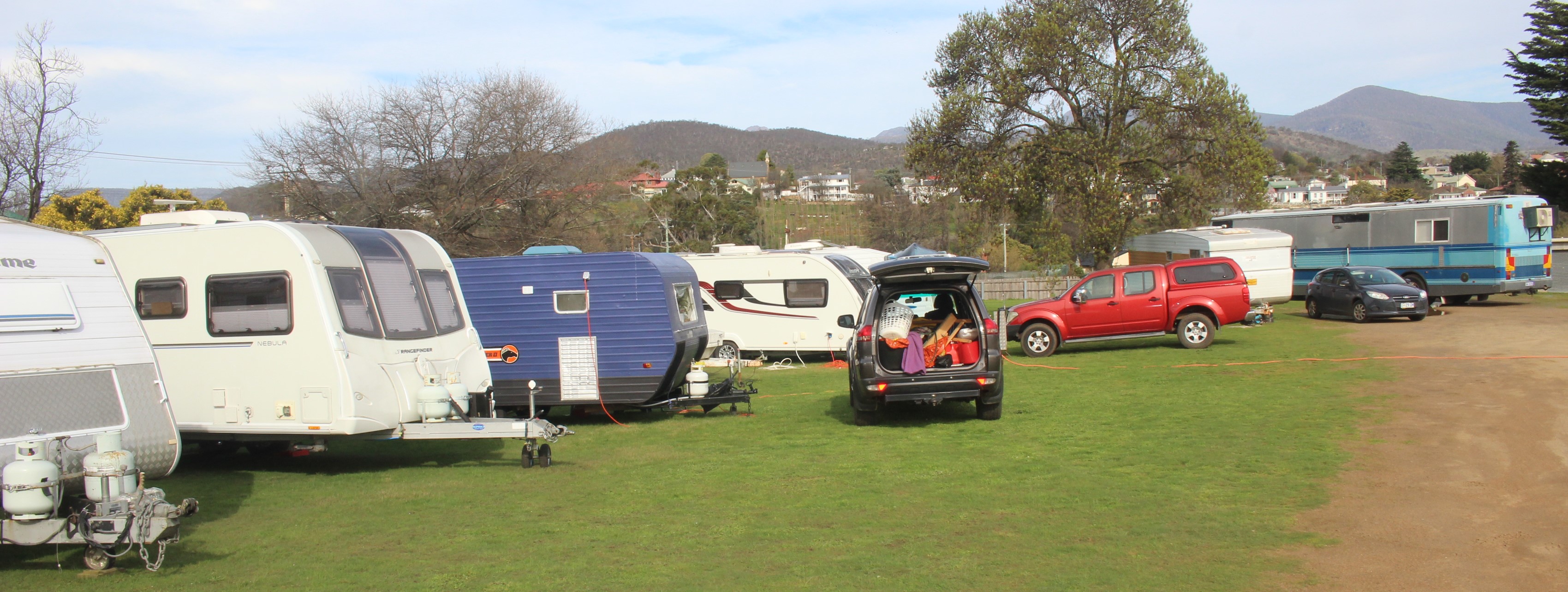
CARAVAN PARK EVACUATED
The 26 residents of the always-vulnerable New Norfolk Caravan Park – along with their goods, chattels and vehicles – have been evacuated to Boyer Oval.
It was a job largely done in the dark of Friday night.
Over the weekend, Council maintenance crews, 8 to 10 staff, began moving through low-lying areas, setting road access controls, clearing debris and cutting up trees dropped by super-wet soils.
“By the Sunday, there were a lot of people doing long days,” says Meg, who herself is an SES volunteer (along with her husband) as well as working for Derwent Valley Council.
At 7 am on the Monday morning, Meg is already fully caffeinated – “the local baristas are the real heroes,” she laughs – and geared up to tackle the worst.
This is a woman who worked at Huon Valley Council during their last emergency, the fires of 2019. She’s ready.
Over at the Forward Command on Bathurst Street, a priority list is forming quickly.
Close attention is being paid to the flood gauge at Bushy Park, where the Derwent’s level is already two metres higher than normal, and rising.
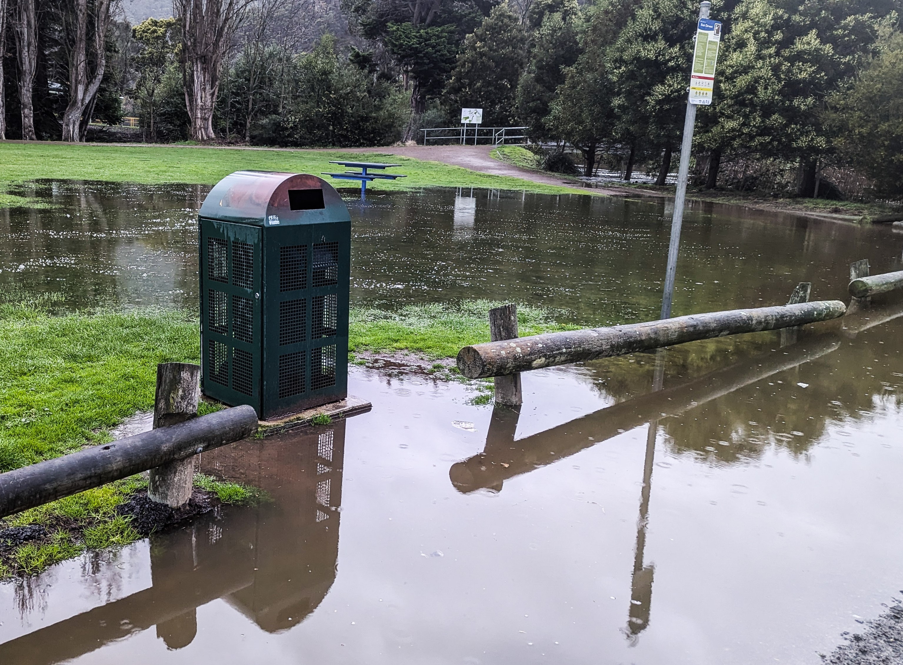
That same water will be at the Esplanade – spilling over its edge, to be exact – in about 6 hours. Whatever needs to be done along the river, just below the town… that’s the timeframe.
Glenora Road is closed, under water at its usual spill points. It will need resurfacing for 150 metres of its length, and a contractor is quickly readied to arrive the next morning, first thing.
(The job is actually done and dusted by midday, Wednesday.)
LYELL HIGHWAY UNDER PRESSURE
The Lyell Highway beyond Hayes is a state government responsibility. Closed Monday morning, it’s under pressure (and will be soon down to one lane after being undermined on the Derwent side) and there’s concerns about Black Hills Road and how much traffic it might need to absorb.
With that data, the conversation refocusses on what else is going on now, and what the modelling says about what’s next. So it will be for the next 48 hours.
Come Wednesday, September 3, and the teams – Council largely in the lead – have moved into damage assessment.
The Caravan Park on the Esplanade, for a start, is going to need to months of work, infrastructure replaced, electrical distribution systems and outlets refitted.
That’s after the cleanup of ruined outdoor furniture and barbeques, pet kennels and potted plants, the fabric of human lives left behind just days before.
It’s time to start figuring out what Council needs to rebuild and replace, and what Nature will need to take care of.
There’ll be a lot of large dollar numbers and questions of how it all gets paid for.
That question will wait, at least for now.


Add new comment